Showing posts with label Pre Historic. Show all posts

Monday, May 20, 2024

Unveiling Mallapadi: A Journey Through Time - Part 1

Mallapadi, nestled within the Krishnagiri district of Tamil Nadu, India, whispers tales of the past echoing with ancient lives and resonates with the pulse of the vibrant present. Unraveling its layers, we embarked on an enthralling journey through pre-history, history and the contemporariness of this intriguing place. While researching on the "Barramahal/Baramahal" (former name of Krishnagiri) or the twelve forts, we stumbled upon many forts in the district of Krishnagiri. However, amongst the many forts, the forts that constitute the Baramahal is yet to be clear.

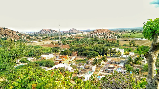
Mallapadi Hill 

Recently, we found a source that clearly pronouncing the 12 forts though still there lies some ambiguity in it. The list of twelve forts are as follows, (please wait for a separate and detailed post on Baramahal once we have explored all the 12 forts) - 1. Krishnagiri 2. Jagadevi 3. Arungarh (?) 4. Sudarshanagarh (Thattakallu Fort) 5. Shimmagarh (?) 6. Kavalgarh (Nagamalai Fort) 7. Maharajagarh (MaharajaKadai fort) 8. Bujangarh (?) 9. Gaganagarh (Periyamalai Fort) 10. Kattoragarh (?) 11. Mallikarjunagarh (Mallapadi fort) 12. Varanagarh (Veerabhadradurga Fort)

With Mallapadi fort, we were able to complete exploring 8 out of the 12 forts constituting the Baramahal. The details of the remaining 4 are obscure, needing more groundwork to identify their locations. Though a few forts have been identified by us in Krishnagiri and its surroundings as probable contenders, the names can be confirmed only after exploration.

Mallapadi fort is classical example for the Baramahal forts, built on a hill top and surrounded by forests. This Vanagiridurgam is one among the lesser known forts of Tamil Nadu and a very significant prehistoric site, considering that this was the first documented rock art site of Tamil Nadu.

Crowning the hills of Mallapadi stands an enigmatic fort, lost in the mists of time. Its origins remain shrouded in mystery, with estimates ranging from the Pallava era (4th-9th centuries CE) to the Vijayanagara period (14th-16th centuries CE). Built using locally sourced granite, the fort has imposing walls that snake along the hill's contours, offering strategic defense against invaders. Remnants of the fort include bastions, gateways, and watchtowers. The existing fortification can be attributed to the Channapatna Palegar Sri Jagadevaraya who was a Vassal of Vijayanagar Empire.

The Climb
Our exploration begins deep in the mists of time, around 30,000 years ago. The land whispers of early inhabitants who etched their stories onto the canvas of time – intricate rock art adorning the Mallapadi hills. Animals, hunting scenes, and geometric patterns whisper of their beliefs, rituals, and daily lives, offering a glimpse into a bygone era. These rock arts stand as silent sentinels, testaments to the earliest known human settlements in the region. These rock arts were first discovered by Archaeologist from Chennai University in 1980 and the paintings here are the testimony to the fact that horse were domesticated in South India as early as Megalithic period ( at least 2500 - 3000 years before). We were unable to explore this part of the hill due to paucity of time. However, we were fortunate enough to find rock art in a shelter on the way towards the fort although we are unsure about the documentation of this rock art in the existing records.

The Rock Shelter 

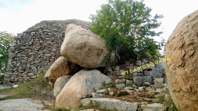
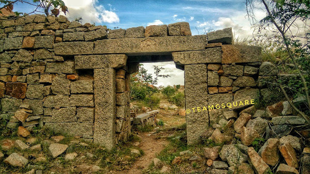
The Fort Wall

The Cave Painting 
We are habituated to investigating possible rock shelters for the presence of any rock art or paintings, and since this place had already been documented as a rock art site, it made us more curious to investigate the rock shelters we encountered during our ascent. We found one which carried rock art. All the paintings found here were white in color and similar to the rock art the patterns documented in its surrounding areas. We continued our ascent and reached the second tier of the fort with not much difficulty as the path was well marked. We noticed a modern shed which housed a beautiful carving of Anjaneya Swamy on a boulder. That was no surprise! Can a fort exist without its protector Anjaneya Swamy!? After taking his blessings, we rested for a while and took a break for having our breakfast.

Kote Anjaneya Swamy 
Hereon the trek turned out to be a little tricky due to the absence of a clear route. It was evident that the trek up to the fort here onwards was rarely undertaken, and this made our exploration all the more exciting! Upon investigation of probable routes to the top, we found one that had markings although it seemed following it would not lead us towards the fort. We however decided to explore this route first as we were not aware of what was there. Following this route led us to a natural cave, probably a rock shelter used by prehistoric men and later used by the Siddhars during different time lines. This natural cave was spacious enough for accommodating people and opposite to this cave were two small water ponds which probably served as a water source back then for people who took shelter at the cave. The views from here were mesmerizing and gave us a clear picture of what could be instore for the remaining part of the trek.

The View 

Water Source 
To be continued...

Friday, December 13, 2019

Dolmens of Talavadi

While ascending the Talavadi hill, we spotted a Dolmen-like structure on its neighboring hillock. I had marked in my mind to explore this hill after our descent. Once we were at the base of the hill, we went ahead to explore the Dolmen/megalithic site. A short climb led us to a flat portion of the hill and we walked straight to reach the Dolmen site. Yes!  It was a huge dolmen with a stone circle. But the sad part was that it remained slightly damaged, although most of its parts were in place.   The stones used for the construction of Dolmen were huge and nicely dressed, having an even surface. The size of the capstone of this Dolmen was roughly around 6 feet by 6 feet in length and breadth with its depth/height varying between 4 to 10 inches.
Disturbed Dolmen (No.1)
There was a natural water pond nearby and while exploring this area, we found another dolmen with a stone circle. But this had been completely destroyed with just one of its stone slabs standing, while the rest were missing. Probably the stones were removed from here by miscreants. This stone Dolmen is very similar to the first Dolmen in its dimensions, going by the sizes of the stone circle and stone slab. After finding this, we became more curious and started to investigate this small hillock for more such structures. We went on to find another stone circle that lay completely disturbed. While walking around the hill, two fully intact Dolmens on another neighboring hill caught our attention and we were intrigued to explore that too!!!
Remains of Dolmen With Stone Circle (No.2)

  We tried to figure out the way to this neighboring hill which seemed nearby, but since no direct route was present, we decided to circumvent and reach this hill. This walk was much longer than we thought as we had to cross numerous small hillocks on the way. On one such hillock, we spotted a Dolmen without a stone circle. The Dolmen was in a much better shape though a bit disturbed. Except for its front stone slab, all the others were laid in situ. Probably, this never had a front slab or it has gone missing. An anthill present inside the Dolmen obstructed our view and we couldn’t see much. 
Solitary Dolmen on Hillock (No.3)
Moving on from here and after walking for a good 15 minutes, we reached a check dam. After crossing the check dam, we entered into agricultural lands walking across which we found a bigger Dolmen that had been excavated by the locals in the greed for treasure; the site however would have carried plenty of bones and pieces of pottery. Here in this land, we could spot a few dolmens spread across, but the land comprised of standing crops which prevented us from venturing inside for inspection. Finally, after crossing all the farmlands, we found a small foot route to the hillock on which we spotted the two intact dolmens. 
Excavated Dolmen ( No.4) 
Dolmen Along With Standing Crop (No.5)
Intact Dolmen ( No. 6 &7)
Finally, after exploring the area, we reached the spot that had intact dolmen giving us a fair idea of the Dolmens once stood here. One of them had a porthole on the eastern stone slab and only one we had come across here with a porthole. These two were also so same size we had come across in this area. Though nothing remained inside these dolmens, it was good to see them intact. From here we took another route where we came across the place that looked like an ancient quarry site. Little further we found the fort wall probably the first tier of the Talavadi Fort. So we completed the circumventing the hill on which we spotted the dolmen. Thus completing adventurous trek and exploration.
Talavadi Hill in the Background
Dolmen No.6 
Broken Port Holed Slab 
Our efforts to find any documentation related to this place went in vain. By looking at the style and sizes of the stones, the Dolmens can be safely assigned to a period between 1000 BCE – 300 BCE. There are two articles in the KarnatakaItihasa Academy that mention the presence of megalithic sites around Kootgal Hill, although they fail to mention the existence of these dolmens. We only hope that the remnants survive the test of time and human greed. Megalithic structures are mysterious and need in-depth study in order to understand their purpose, rather than superficially relating them to burial practices. Of late, a lot of research is being carried out in this direction in order to gain more clarity.
Related Posts:

Thursday, November 16, 2017

Kurugodu, Bellary - Fort, Prehistoric Paintings and Ancient Temples


Kurugodu, Bellary - Fort, Prehistoric Paintings and Ancient temples
A Panoramic View of Kurugodu Fort, Town and Hills
Though traveling to Kurugodu was fairly regular when I was in Bellary, we could never manage to make enough time for exploring this place. The 'Hill Fort of 'Kurugodu' has always been inviting and many of our travel and historical books speak in volumes about it. The level of eagerness to explore Kurugodu reached its highest at one point and culminated with us planning a road trip to Bellary during the holidays of Deepavali, last year. Trust us! This place undoubtedly exceeded our expectations. Our previous day was quite exciting, with the highlight of the day being the prehistoric anthropomorphic sites of Kumathi and Hulikunte. This day, we planned to explore the prehistoric sites of Sanganakallu and Kuppagallu and in anticipation of a really hot day, we started quite early and reached Sanganakallu. As Mr. Ramadasa, our guide for the day who knew every stone of Sanganakallu was held up with other work and promised to meet us the next day, we decided to go ahead to the next place on our list, Kurugodu.
Shiva Mandapa, Kurugodu Fort
A Bird's Eye View of Shiva Mandapa 
History of Kurugodu and Kurugodu Fort: Kurugodu is believed to have been a part of the Kishkindha kingdom ruled by the monkey brothers Vali and Sugreeva during the Treta Yuga (period when Lord Rama ruled the earth). Later in the Dwapara Yuga, this place became the capital of the Kuntala kingdom ruled by the great king Chandrahasa. The town of Kurugodu, surrounded by many small hillocks, proved an ideal environment for the then prehistoric settlement. There is ample evidence given by archaeologists in the form of artifacts to prove that this site was once occupied by prehistoric men. A few cave paintings found here can be traced back to the Bronze Age, with the others belonging to the Iron Age. Though there are no records of Kurugodu's association with the Mauryan empire, findings from the Ashokan edicts at Nittur and Udegola which are in close proximity to Kurugodu confirm that Kurugodu was once under the rule of the Mauryan kingdom. An inscription found here dated to around 2nd century AD confirms that this place was also under the rule of the Satavahanas between 2nd and 3rd centuries AD. Subsequently, it came under the control of the Badami Chalukyas after which it gave rise to one of the lesser know dynasty, the Sindhs of Kurugodu. The Sindhs ruled Kurugodu from 7th century till the end of the 12th century, with their descendants seen living even now at Kurugodu. King Ariballi Dagra established the Kurugodu Sindh Kingdom followed by Udayaditya, Chokarasa, Rachamalla I (the most successful king of this dynasty), Rachamalla II and Veerakalidevarasi. The fort of Kurugodu was built by the Sindh kings way back in the 10th century and was later improved by the Vijayanagara Kings. This fort is four tiered, with its bottom most tier of fortification encircling the entire town of Kurugodu and its surrounding hillocks. At a later stage, Hyder Ali captured this fort and post the death of Tippu Sultan, it was left abandoned.
Kurugodu Fort
Kurugodu Fort Walls
Bird's Eye View of Hale Kurugodu
Tungabhadra canal
Tungabhadra Canal Traversing Across Paddy Fields
Kurugodu Fort
Kurugodu Fort
Having been to Kurugodu many times and hence being familiar with its surroundings, we easily found a decent place to park our vehicle and reached the base of the hill. Hereon, two men volunteered to accompany us and guide us along. They informed us about the presence of two routes, one laid with proper steps and the other with a rough path through thorny shrubs, which turned slippery at times. For us, taking the the tougher route was quite an obvious choice. The climb was slightly difficult, though a short one and we reached the first tier of fortification from where there were two diversions, one leading to the Shiva mandapa and the second to the next level of fortification. Reaching Shiva mandapa was quite tricky. It is a small mandapa housing a beautiful Shiva Linga, installed by the Sindh kings who were staunch followers of Veerashaiva dharma. The climb from here towards the second tier was quite easy. There is a temple dedicated to Lord Anjaneya with an inscription carved on stone, of the Vijayanagara Kings. From the top of this hill, we were able to spot many temples on the other side of Kurugodu, and upon inquiring, our guide informed us about Hale Kurugodu or Old Kurugodu, which was once a prosperous town under the Sindhs, but now is in ruins and shambles. They gave us all the details of the temples there. We explored the remains of the fort, most of which were still intact. There are many interesting balancing rocks here. Our descent was quick and we asked our guides if they were also interested in showing us around Hale Kurugodu. Their response was negative and they also went on to advise us not to explore that side of the place as it had turned into a drunkards den and would be unsafe. We thanked our guide and bade them good bye. We stopped by a small shop to buy some snacks and prepare food for our little one. We bought a few fruits here for which Kurugodu is known for. Kurugodu and its surroundings are well known for the excellent quality of Pomegranate, Fig and Papaya they grow, most of which are exported.
Kurugodu Fort
Balancing Rock inside Kurugodu Fort
An Inscription Outside Lord Anjaneya Temple 
Lord anjaneya inside Kurugodu Fort
Lord Anjaneya
Balancing Act by Rocks
Kurugodu Fort
Lord Anjaneya Temple and Fort Walls
Lord Shiva, Kurugodu Fort
Lord Shiva
We decided to explore the temples which we saw from atop the hill and proceeded further. We found ruins of many temples here and a little further on a rock we spotted some red colored paintings. We parked our vehicle to investigate the place and to our surprise, they were indeed prehistoric paintings. We were able to identify the paintings of hyena, bulls, people and many other worn out paintings. So excited we were! It seemed for a second like it was our own discovery! We explored more around this area with an expectation of finding other paintings, but no luck. There was a person working nearby this site and on inquiring him about the presence of any other such paintings around, he looked blank and admitted of being totally unaware about them. HeyI requested him to come along to the rock where we saw the paintings to know if he could recollect having seen similar paintings elsewhere, but his answer was negative. He went on to confess that he never knew about these paintings and its significance, but will keep in mind the same from now on. He suggested us to see a cave temple with some carvings of kings a little further. We thanked him and carried on with our explorations.
Prehistoric Rock Shelter, Hale Kurugodu
Prehistoric Cup-marks , Bellary
Prehistoric Cup-marks 
Prehistoric cave painting, Kurugodu, Bellary
Painting Depicting Hyena 
Prehistoric cave painting, Kurugodu, Bellary
Unidentifiable Cave Paintings
 To be continued….. 


Related Posts:
Rock Carvings of Usgalimal

Thursday, November 9, 2017

Gudekote, Bellary - Cave Paintings, Fort and Bear Sanctuary

Gudekote Fort
Exploring Gudekote Fort with our Young Trekker
'Gudekote' is a small town situated on the Bellary/Ballari - Kudligi State Highway. As usual, having passed by this place many a time, we had an urge to visit here but never got a chance to do so. Finally during the last year Dasara holidays, we managed to plan a visit to this place. It was quite hectic and we started the day by exploring the Fort at Ramadurga, Shree Ramalingeshwara Cave Temple, Nayakanahatti Temple and the Prehistoric Sites of Kumathi and Hulikunte. We reached Gudekote around 4.15 pm and were contemplating whether or not to climb the hill fort as this place has been declared as a bear sanctuary. We inquired at a few places and found it safe to climb the hill and decided to give it a shot. We parked our vehicle and walked towards the hill in pursuit of another exciting adventure.
Gudekote, Bellary, Karnataka
Four of the Five Hills surrounding Gudekote as viewed from the Doregala Hill
Birdseye View of Gudekote
Bird's Eye View of Gudekote
History of Gudekote and Fort: Gudekote is derived from two Kannada words, 'Gudi' meaning  Temple and 'Kote' meaning Fort. Hence, Gudekote literally means a Temple-Fort. There are 5 hills surrounding the town of Gudekote namely, the Doregala Gudda, Someshwara Gudda, Agasara Gudda, Harijana Keri Gudda and Karadi Gudda. Gudekote was occupied since the Neolithic period, and many prehistoric artifacts have been discovered by researchers here. Later this place is said to have been under the rule of the Mauryan dynasty, based on the Ashokan edicts found at Brahmagiri, Ashoka Siddapura and Jatinga Rameshwara. It then came under the rule of the Satavahanas, the Kadambas, Badami Chalukyas, Rashtrakutas, Kalyana Chalukyas, Hoysalas and the Palegars (chieftains) of Hosamaledurga. Subsequently, the Gudekote Palegars under the patronage of Vijayanagara Kings ruled this place between 1506 AD and 1757 AD and gave a tough fight to the Bahmani dynasty. King Gundala Nayaka established the Gudekote Palegar Kingdom, followed by Bommatharaja, Chinnayaraja, Immadi Rajjappanayaka, Jatingi Raja, Ramappanayaka, and Shivappa Nayak. The Gudekote Palegars improved the mud fort here by replacing it with a strong stone fort during the 16th century. This place was captured by Hyder Ali and later went fell into the hands of the British with the defeat of Tippu Sultan, who had control over this place till 1947 which later was added to the then state of  Mysore.
Gudekote Fort Trek
The Initial Climb
The Young Trekker Growing out of Shadows
After a short climb, we reached a site that seemed like a prehistoric settlement or rather would have been a perfect place to have one! The cave paintings here only confirmed that this site indeed was a prehistoric settlement. Though most of the cave paintings have been vandalized by modern graffiti, we were able to identify a few, with most of the remains seeming no less than a puzzle! The paintings were similar to the ones at  Jatinga Rameshwara and Anegundi, and hence must have belonged to the same period. We spent quite a good time here trying to decipher these paintings, as it always arouses the sense of creativity, imagination and humor in us. Deciphering paintings has always been a fun activity and hence we enjoy it. After a while, we proceeded further.
Prehistoric paintings Gudekote
Cave Paintings
Prehistoric rock shelter Gudekote Bellary
Cave Paintings and The Rock Shelter
Gudekote, Forts of Karnataka
Gudekote Fort
We were greeted by the first tier of the fortification which opens into a flat land, perfect to have a settlement. There were remains of a few buildings and also a stepped well. On exploring the area, we found another building structure of a much later stage, probably built by the British. This place seemed like a storage place for food, being devoid of any doors. We found a unique carving on a rock further, resembling that of a soldier with a spear in hand, and with very assertive and alert eyes! We continued our climb further only to realize that there was no clear path hereon, except a few ruins spread here and there. We settled here for a few minutes while the sun was setting behind us and after sometime started our descent. We reached the village and went straight to explore the Tangalli Mahal built in Indo-Islamic style by the Palegars  and  enjoyed the cool breeze there. This must have been a grand two storey structure which sadly today is in shambles. The hills and forests around Gudekote have been declared as a 'Sloth Bear Sanctuary', according to a notification of 2013 and second only such wildlife sanctuary after the Daroji Bear Sanctuary near Hampi of Bellary district.  This however, is yet to be opened for visitors and is considered to be larger than Daroji.
Gudekote fort entrance
2nd Fort Gateway of Gudekote
Stepped Well Inside Gudekote Fort
Dried Stepped Well Inside Gudekote Fort
Stepped Well, Gudekote, Bellary, Karnataka
Another Dried Stepped Well
Carving, Gudkeote fort, Bellary, Karnataka
Unique Carving
Gudekote, Forts of India
Ruins Inside Gudekote Fort
Store house, Gudekote Fort, Bellary, Karnataka
Store House Probably Built by the British
We also remember seeing a few rock paintings on the Gudekote - Bellary road during our other travels. Being very curious each time we saw them, we decided to check out what was in store this time and reached that spot, which falls inside the limits of a Bear Sanctuary. There were a few unique cave paintings under rock-shelters which were quite difficult to decipher. The sunset was an indication to end the day's adventure. It was a great day, one of those where we explored 2 forts, a beautiful cave temple, a popular local pilgrim center and 3 prehistoric sites. Hereon, we drove towards Bellary for our next adventure.
Tangalli Mahal, Gudekote, Bellary
Tangalli Mahal
Gudekote Bear Sanctuary Karnataka
Prehistoric Rock Shelter With Paintings
How to reach Gudekote: Located on the Bellary - Kudligi road, it is about 60 km from Bellary and 30 km from Kudligi. 
Accommodation: There are no options available for accommodation in Gudekote. One can stay at Kudligi which has limited options, however the best would be to find a stay in Bellary overnight. Our usual place of halt is Hotel Ashoka Residency with an affordable budget.
Places to Visit Around Gudekote: Sandur, Kudligi, Kotturu, Ujjaini, BrahmagiriAshoka Siddapura, Jatinga Rameshwara, Sanganakallu, Bellary, Hampi, Nayakanahatti, Kumathi, Hulikunte and many such.

References:
1. Book on "Ballari Jilleya KotegaLu" By Dr.M.Kotresh
2. Journeys Across Karnataka

Related Posts:
1. Channarayana Durga Fort
2. Ambajidurga Fort
3. Kavaledurga Fort 
4. Rock Engraving of Usgalimal