Saturday, March 25, 2023

Sunrise Trek - Veerabhadradurga Fort

The Golden Dawn
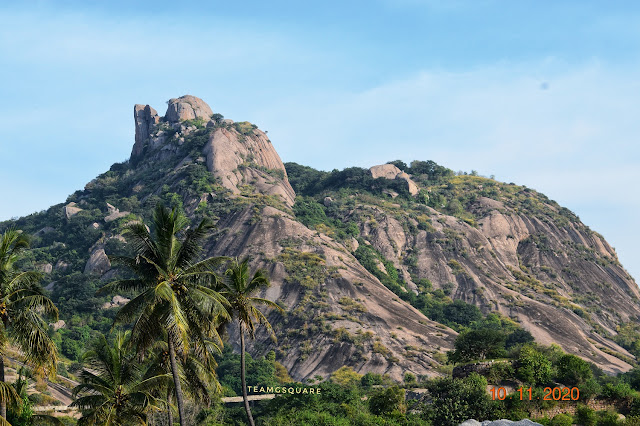
Veerabhadradurga Hill Fort 

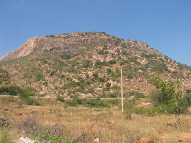
Our quest to complete the ‘Baramahal’ or the ‘12 Forts’ took us to our next destination, “Virabhadradurga/Veerabhadradurga”. Our first task was to get the location of this fort since not much information regarding the same was available on net or elsewhere. However a few months ago, while glancing through g-maps, we accidentally came across the coordinates of this place. At our next possible outing, we decided to check this place out and reached here without any difficulty. Our concern now was to find out the right hill amongst the many hills around on which the fort was located. The first hill looked quite inviting and we wanted to inquire about the route to the top. The local person, who stopped by to respond gave us the correct location of the hill-fort we were in search of. We reached the place and inquired for the trek route from the locals present around. On getting the required information, we parked our vehicle and started the trek. 

The First Gateway to Veerabhadradurga Fort
Sri Kote Anjaneya Swamy

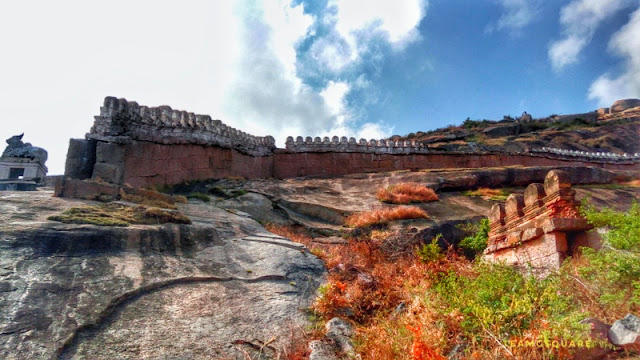
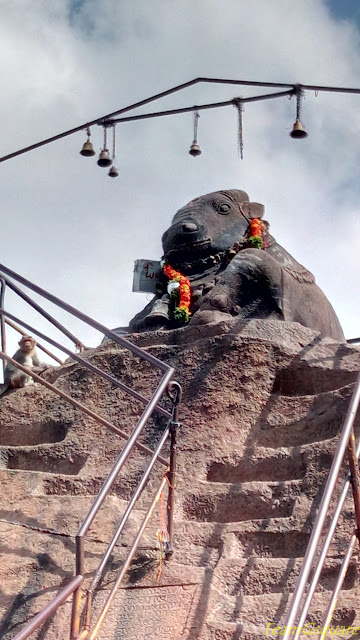
The trek was pretty straight forward with steps laid all along. The route was comparatively clean due to the regular movement of people. The fort of Veerabhadradurga is 7 tiered, with much of its fortification and gateways still intact. There is a beautiful rock carving of Sri Anjaneya Swamy between the second and the third gateway, which is still under worship by the locals. The second gateway opens into a small plateau where minor agricultural activities are undertaken by the locals. The third and fourth gateways are more for the purpose of defense and devoid of any other structures. The fifth gateway opens into a bigger plateau area. 

The Engulfed Fort Walls 
Intact Fortifications

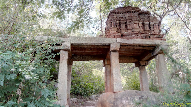
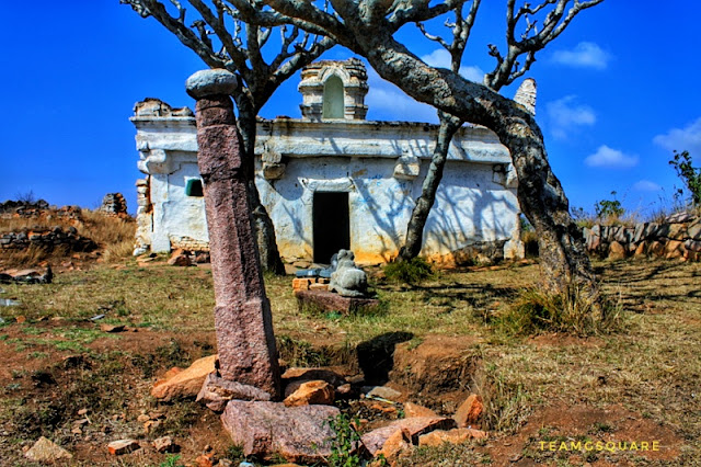
After crossing the fifth gateway and trekking for a while, our eyes were greeted by two ancient temples, one dedicated to Sri Veerabhadra Swamy and the other dedicated to Sri Chennakeshava Swamy. The temple dedicated to Sri Chennakeshava Swamy is a grand structure, but sadly is in a ruined state now. There were no signs of any efforts towards its restoration. Although both the temples were built under the rule of the Palegars, it is very difficult to ascertain who built them and when.

The Fifth Gateway 
Sri Chennakeshava Swamy Devasthana
The Royal Chieftain's Residence 

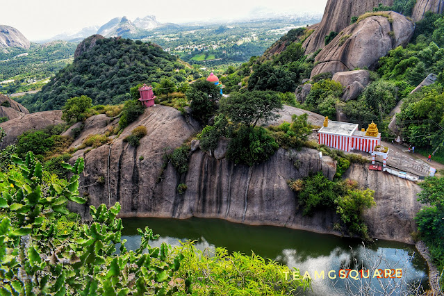
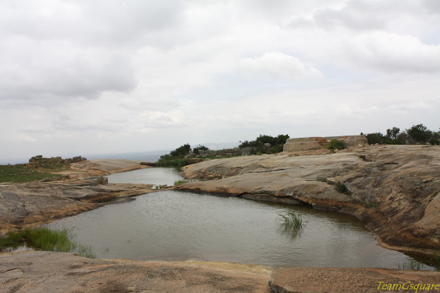
As this fort is one amongst the 12 forts constituting the Baramahal, its association with the Channapatna Palegar Sri Jagadeva Raya cannot be ruled out. However, strangely, a local legend goes on to say that Sri Jagadeva Raya who was then a vassal king under Tippu, jumped into the natural spring well present in the fort premises along with his wealth when Tippu was defeated by the British and the fort was about to be captured. It is believed that the spring is very deep and is difficult to ascertain the depth of it. Hence the wealth was never found. Such folklore was documented by the British and spread across many places. This natural spring well is called Rama Lakshmi Jonai (Jonai: natural spring). 

Rama Lakshmi Jonai (Spring) 
Sri Kote Anjaneya Swamy 
Team G Square 
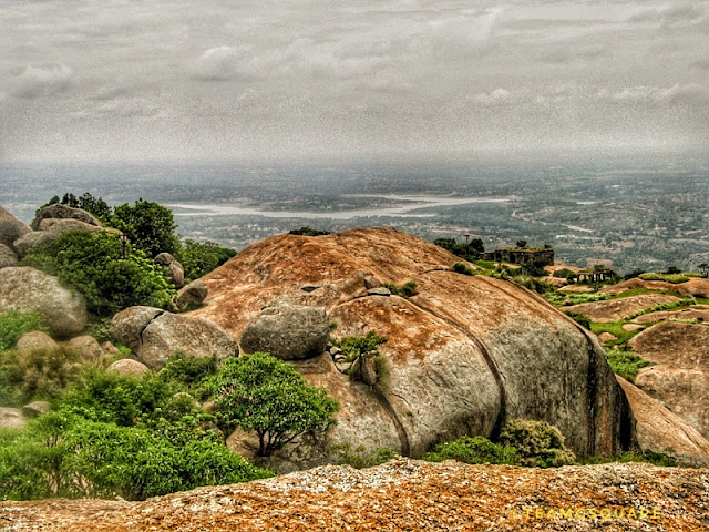
Rama Lakshmi Jonai, a beautiful and serene natural spring well is situated about a 100 meters from the temples. Water here was clean and clear. We spent some time here and decided to explore the top-most tier of the fort. We had to cross the sixth gateway and the route was a bit slippery due to drizzle and the up slope of the hill. We reached the top of the fort (we assumed this was the top most point) and spent some time here enjoying the scenic views and wondered how beautiful it would be to view the sunrise from here.

The Rock-Cut Steps 
Way to Heaven 
The 7th Gateway 
Top Most Tier of Fort Wall 
The Top most Point of The Fort 
The View 
Me 
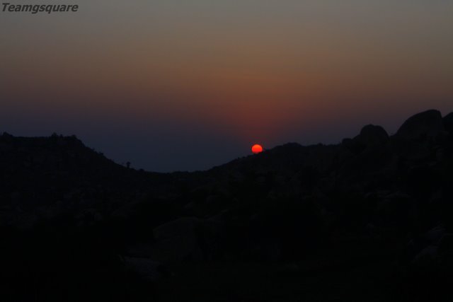
Coincidentally, a few months later, on the 1st of January 2023 we decided to redo this trek to witness the sunrise. The picturesque sunrise was worth every effort taken by us to reach the hill-top in the early hours of the morning. There was another small peak visible from the sixth gateway, apparently the highest point of the hill which we had missed during our last trek. We managed to complete this peak and reach the highest point this time. This fort is also known by other names such as ‘Itikalldurga’ and ‘Sendirayanadurga’.

The Gang
The Early Risers 
The Sun Rise 

At the base of Veerabhadradurga is a grand temple dedicated to Sri Chennakeshava Swamy which is fully functional. Thus another fort from the Baramahal was captured by us! 

The Harvest 

References: 
1. Madras State Gazetteer - Salem

Related Posts:

Saturday, November 19, 2022

The Trident Fortress - Shoolagiri

The Trident Hill - Shoolagiri
The trident shaped hill in Shoolagiri on the Bengaluru - Krishnagiri highway can surely not go unnoticed! Shoolagiri / Sulagiri is located mid-way between Bengaluru and Krishnagiri and derives its name from the presence of a hill resembling the shape of a trident or a trishula. This hill fort was always on our list of places to visit, but never materialized due to various reasons. Our last attempt to trek this hill was abandoned due to the presence of police who were in action in and around the hill to nab a gang of thieves. It was intriguing to see a few police vehicles parked at the base of the hill and moreover the locals advised us not to venture then. For reasons of  safety, I decided against proceeding further and headed back.

 View of the Hill 

A Panoramic View 

This Deepawali weekend, we decided to explore a hill fort situated at the other end of Krishnagiri and drove towards it. Although we left quite early in the morning, we realized it was too late to reach our planned destination due to the bad traffic. As we were about to cross shoolagiri, my partner suggested we could explore shoolagiri instead, as it was pending  since long on our to-trek list. We stopped by and parked our vehicle at a place which we thought could be the starting point of the trek. Upon getting a confirmation of the trek route, we proceeded further and the path was quite easy through shrubby forests, initially with a lot of mosquitoes and later, on the rocks. We crossed a tier of crumbling fort wall and a few minutes later realized that this hill was detached from the main hill and we were on the right most portion of the trident hill. Here on the peak was a small temple dedicated to Goddess Devi and a water pond. After spending some time here and exploring the environs, we decided to get down and find the right route to explore the main hill. 

Entering the Forest 

Temple and the Water Pond 

There was another deviation from the main route at the hill base apart from the one we had taken to reach the right most portion of the trident hill. Now that our aim was to reach the other portions of the hill, we decided to trek along the other route. After a while, we realized that this route was not taking us in the right direction and hence decided to back track and reach our vehicle. We met a shepherd there who gave us details about the right route to reach the fort. For this, we had to drive through the village of Shoolagiri for about ten minutes and reach an ancient temple dedicated to Sri Varadharaja Perumal (Shri Vishnu). This is a  beautiful temple lost in the by-lanes of history  and we were glad to see that the temple remained open. We had the darshan of  Shri Vishnu and  Lakshmi Devi. It is believed that the murti here was installed by Arjuna, one of the Pandavas during their exile. The temple is a classical example of Vijayanagara architecture/Karnataka Samrajya. 

Sri Varadharaja Perumal Temple
Matsyavatara 
Kote Anjaneya Swamy
Kote Anjaneya Swamy
On inquiring about the route details for reaching the hill top with the locals around the temple, we were advised to step back from attempting our climb as the route was supposedly left unused for a long time and was completely covered with vegetation, mostly thorny shrubs owing to the good rains in the region. However, we had made up our minds to continue further and see whats in store for us here, and thus began another interesting trek in search of the abandoned fortress of Shoolagiri. As we started our trek and began to walk for a while, we reached dead ends on two different routes and it appeared as though we were going nowhere. We weren't ready to give up this early and tried to investigate a few other routes. While our little partners decided to save their energies by resting, we both began to inspect at different places for the possible route and as the saying goes we tried till we succeeded! We found a possible route hidden amidst vegetation and signaled our little trekkers to join in. It was a quite hot noon and due to the vegetation, there were a lot of mosquitoes around making the trek more uncomfortable. We continued our trek, playing hide and seek with the sun. Reaching the first gateway filled in some confidence in us about being on the right path and here on followed our gut to cross the second, third, fourth and fifth gateways.  We reached a point that is always visible from the highway and resembles a vantage point with a cannon placed, although there are no traces of any cannon today. Hereon, we reached a dead point from where we could not find any possible route to climb up further to the fort top. 
In Search of the Abandoned Fortress of Shoolagiri

The Crumbling Fort Wall 

The Right Pathway 

The First Gateway 

The Second Gateway 

The Vantage Point View of Shoolagiri Town 

Our real adventure began here as we found a foot route in between which later vanished into thin air. We reached the 6th gateway amidst thorny vegetation and shade. Crossing this stretch was more exciting as we had to maneuver by crawling at a few places. After a while, we reached a point from where the hill top was visible. This was the last stretch of our climb on the slippery path and bang on...we were at the top of the left most portion of the trident hill.  There were a ruins of a small structure on the top, which possibly was a  storage place for ammunition. We rested for a while here and looking around, we spotted the 7th gateway which we missed during our ascent. We realized we had made our own path to reach from the sixth to the seventh gateway.  After spending sometime at the top, we started to descend. During or descent, we realized that the route to the central portion of the hill was less accessible and a little risky to attempt. Therefore, we decided against attempting the central portion of the hill and tried to reach the base at the earliest. Thus capturing another fortress in Krishnagiri. 

The Rock Shelter 

The Way Up 

In Search of the Path 

Traces of the Fort 

Walk on the Edge 

Forest Pathway 

The View 

History of Shoolagiri Fortress: Shoolagiri Samsthana was probably formed by the rebels of Ankushagiri Palegars and led by Sri Hirannya Gouda after taking over both Shoolagiri and Ankushagiri in the end of 17th century, during the fag end of  the Vijayanagara Empire. Later it came under the rule of the Marathas, the British, Tippu and later returned to the British rule after the death of Tippu. The British handed over the fort back to Palegar Rana Chokka Gouda's son, Hirannya Gouda III and their family ruled till the attainment of independence.

Ammo Room 
7th and the Last Gateway 

  Related Posts: 

1. The Forgotten Fort - Ankushagiri 

2. The Mysterious fort - Udedurgam 

3. Forts of Karnataka 

Friday, July 1, 2022

Rehmangarh/Kaivara Fort

Though we were aware of the presence of two mighty forts between Kaiwara and Chintamani, there was always an uncertainty of the sheer existence of these forts as very little or no information was available   on the internet. This made us more curious to explore and one Sunday, it was time to do the same.  We headed towards Kaivara in search of these forts.
Update:- Now this trek is under Karnataka Eco tourism managed by Karnataka Forest Department and can be booked from their website and is charged Rupees 250 per head. 
Rehmangarh Fort , Chintamani
Rehmangarh Fort
Our first stop was a small tiffin centre at the entrance of Kaivara. After having a sumptuous breakfast, we inquired the owner of the hotel about the fort. He had absolutely no idea about any fort around. When we later pointed towards the hill on which the fortification was vaguely visible, he smiled sarcastically saying that the route to the fort was no longer accessible and nobody goes there now-a-days and is completely abandoned. Additionally, he mentioned that we would not make it there. On asking him why he said so, he replied that though there is a route to reach the fort, no one including the locals dares to do that.  His concern towards us was understandable. But, we would never give up! Once we know there was a route, we were determined to trek up and reach the fort.  . He then challenged us saying that we will not be able to climb that hill and suppose we did, then he would offer us free lunch in his hotel!  This was a real bonus, an exciting adventure plus free meals. It was a challenge to us now to capture the fort! And so we headed quickly towards the hill following his directions. 
Kaivara National Park
The Path thru Forest
Kaiwara Fort, Chintamani
The Fort Wall
Fort Gateway, Kaivara
The Gateway
Tippu drop
Tippu Drop
The View from Tippu Drop
We reached the entrance of a mini-zoo-park maintained by the Karnataka Forest Department. The forest guard there was quite surprised by us when we inquired about the directions to the fort, and advised us not to venture there and if we wished to do so, we could at our own risk. He was not too convinced with our decision to move ahead since the route was not safe and difficult to climb and showed his concern for us.  After a brief chat, he agreed and told us to return by 3 pm. We paid the nominal fee for entering the park and proceeded further. From here began our search for the first fort.  Fortunately or unfortunately, he gave u no directions while we proceeded as though we knew the route to the fort! We made our own way until we reached a path that looked like a shepherd’s route.  The ascent hereon was quite easy and pleasant. Within no time we reached the top of the first hill from where the fort was at a striking distance. We found a way towards the fort and started walking. The rest of the climb was simple and plain.
Forts near Bangalore
Ruined Structure and Water pond

Lord Veerabhadra Swamy Temple, Kaivara
Lord Veerabhadra Swamy Temple
Forts of Karnataka
The Fort Ruins
Lone Microwave Station
The fort was built by local Palegars and later improved by the Tippu Sultan. This conspicuous hill fort rises to a height of 4200 feet above sea level. There is a temple dedicated to Lord Veerabhadra Swamy and a small pond of water besides.  A point on the edge of the hill was served as a place to kill the sinner by Tippu, who dropped them from that high point. It reminded us of Tippu drop of Nandi Hills. Not many structures remain on the fort apart from a few ruined ones.  The strong and lonely fort walls have many stories buried within them. The different views from atop the hill were mesmerizing but for us, the most striking one was that of a hill higher than this with a fort like structure.   After resting a while, we started our descent and reached the park that housed a small zoo having nothing more than rabbits, swans and peacocks.  Though the premises have been fairly maintained, we felt a little extra care needs to be put in by the concerned.  The guard became friendlier once we returned and spoke to us calmly.  Very surprisingly, he was not aware of the exact name the hill carried and quoted names like Kaivara fort, Anegundi fort, Tippu drop, Permachanahalli fort, etc. We headed directly to the shop situated right opposite to the park and quenched our thirst drinking some refreshing mango juice.  The lady at the shop was shocked and said most of the people who get in to climb up the hill return after trekking half way.  Now the time had come to redeem our reward of a free meal and reached the hotel.  The challenger had a broad smile on his face and was not ready to believe we had actually done it. We had to convince him by showing a few clicks of the fort as proof.  Very kindly, he offered us lunch while we thanked him and moved on.
The View
Bird's Eye View of B C Road
At the Tippu Drop
 How to reach Kaiwara/Kaivara: Bangalore - NH75 - Hoskote - SH 82 - H Cross Continue further till Kaivara cross - Left turn - Kaivara towards Kaivara zoo (Fort is inside this Zoo). About 70 Km from Bangalore.
The hunt for the second fort begins…..
Chintamani Fort
Quite Inviting
Related Posts: